Accurate inspection data that reveals what's hidden
ABS Drones and Thermal Imaging combines high-resolution drone technology with thermal imaging to identify structural issues, water ingress, and anomalies across Australia. We deliver the data you need for solar farms, agriculture, industrial infrastructure, and emergency response.
Advanced inspection technology, built for Australian infrastructure
ABS Drones and Thermal Imaging started with a clear mission: deliver accurate, actionable data that reveals what the naked eye can't see. Using high-resolution drones and handheld thermal cameras, we identify structural issues, water ingress, and thermal anomalies across solar farms, agriculture, industrial infrastructure, and emergency response situations. Based in Bundaberg and operating Australia-wide, we combine precision technology with local expertise to solve real problems for our clients.
Qualifications Matter
ABS Drones and Thermal Imaging is the specialist drone and thermal imaging division of Australian Biosecurity Services Pty Ltd, providing professional aerial and ground-based inspection services across Australia and offshore. We combine professional UAV operations with Level 2 thermography expertise to capture, interpret and report high-quality visual and thermal inspection data. Our inspection services support renewable energy, agriculture, industrial infrastructure, asset management, insurance and other applications where accurate inspection data matters. THERMAL IMAGING: QUALIFICATION MATTERS Not all thermal inspections are equal — and poor thermography can result in costly decisions. Thermal cameras are becoming increasingly common, but owning a thermal camera or flying a thermal drone does not make someone a qualified thermographer. At ABS Drones and Thermal Imaging, our thermography capability is supported by Level 2 qualified thermographers and professional affiliations with AUSTPA, AINDT and AAUS. That matters. Accurate thermal imaging requires far more than taking coloured images. A qualified thermographer understands the science behind what the camera is measuring, including emissivity, reflected temperature, environmental conditions, solar loading, measurement range and span, thermal patterns and equipment operating conditions. Without understanding these factors, thermal images can be misinterpreted, resulting in false positives, incorrect diagnoses, unnecessary investigations, downtime and avoidable expense. This applies to both handheld thermal inspections and aerial drone thermography. OUR INSPECTION CAPABILITIES SOLAR FARM INSPECTIONS Aerial visual and radiometric thermal inspections of commercial and utility-scale solar assets to identify thermal anomalies and potential module, string and equipment issues. Inspections can be conducted in accordance with recognised industry methodologies, including IEC 62446-3 where applicable. AGRICULTURE & IRRIGATION Thermal imaging can identify irrigation irregularities, potential water loss and variations that may warrant further investigation, helping primary producers improve irrigation management and reduce unnecessary water use. INDUSTRIAL & INFRASTRUCTURE INSPECTIONS Aerial and ground-based visual and thermal inspections of industrial assets, infrastructure, structures and difficult-to-access areas. WIND TURBINE INSPECTIONS Drone-based visual and thermal inspection applications for wind energy assets and associated infrastructure. INSURANCE & DAMAGE ASSESSMENT High-resolution aerial and thermal imagery to document asset condition, damage and areas requiring further investigation for insurance, maintenance and reporting purposes. ENVIRONMENTAL & EMERGENCY APPLICATIONS Drone-based visual and thermal data collection for environmental monitoring, incident assessment and emergency response applications. MAPPING & DATA CAPTURE High-resolution aerial imagery, mapping and 3D data capture for inspection, measurement, documentation and asset management applications. WHY QUALIFICATION MATTERS Before engaging anyone for thermal imaging, ask: ✔ Are you a qualified thermographer? ✔ What thermography qualifications do you hold? ✔ Do you understand emissivity and reflected temperature? ✔ How do you account for solar loading and environmental conditions? ✔ Can you explain measurement range and span and how they affect interpretation? ✔ Do you understand the limitations of thermal imaging? ✔ Can you explain the methodology used to reach your findings? Thermal imaging is a measurement science — not simply photography with a thermal camera. WHY ABS? LEVEL 2 QUALIFIED THERMOGRAPHERS Professional thermography expertise supporting both aerial and ground-based inspections. UAV & THERMAL CAPABILITY We combine drone data acquisition with professional thermal interpretation. AERIAL & GROUND-BASED INSPECTION We select the appropriate inspection method and equipment for the asset and application. INDEPENDENT, COMPLIANCE-FOCUSED REPORTING Clear findings designed to support informed maintenance, asset management, insurance and operational decisions. AUSTRALIA-WIDE & OFFSHORE ABS Drones and Thermal Imaging can deploy inspection capability Australia-wide and for offshore projects. WHEN THERMAL IMAGING MATTERS, QUALIFICATION MATTERS. Get accurate data. Understand what it means. Make informed decisions.
Drone aerial inspection
High-resolution aerial imaging to capture structural detail, roof condition, and hard-to-reach areas safely and efficiently.
Thermal imaging analysis
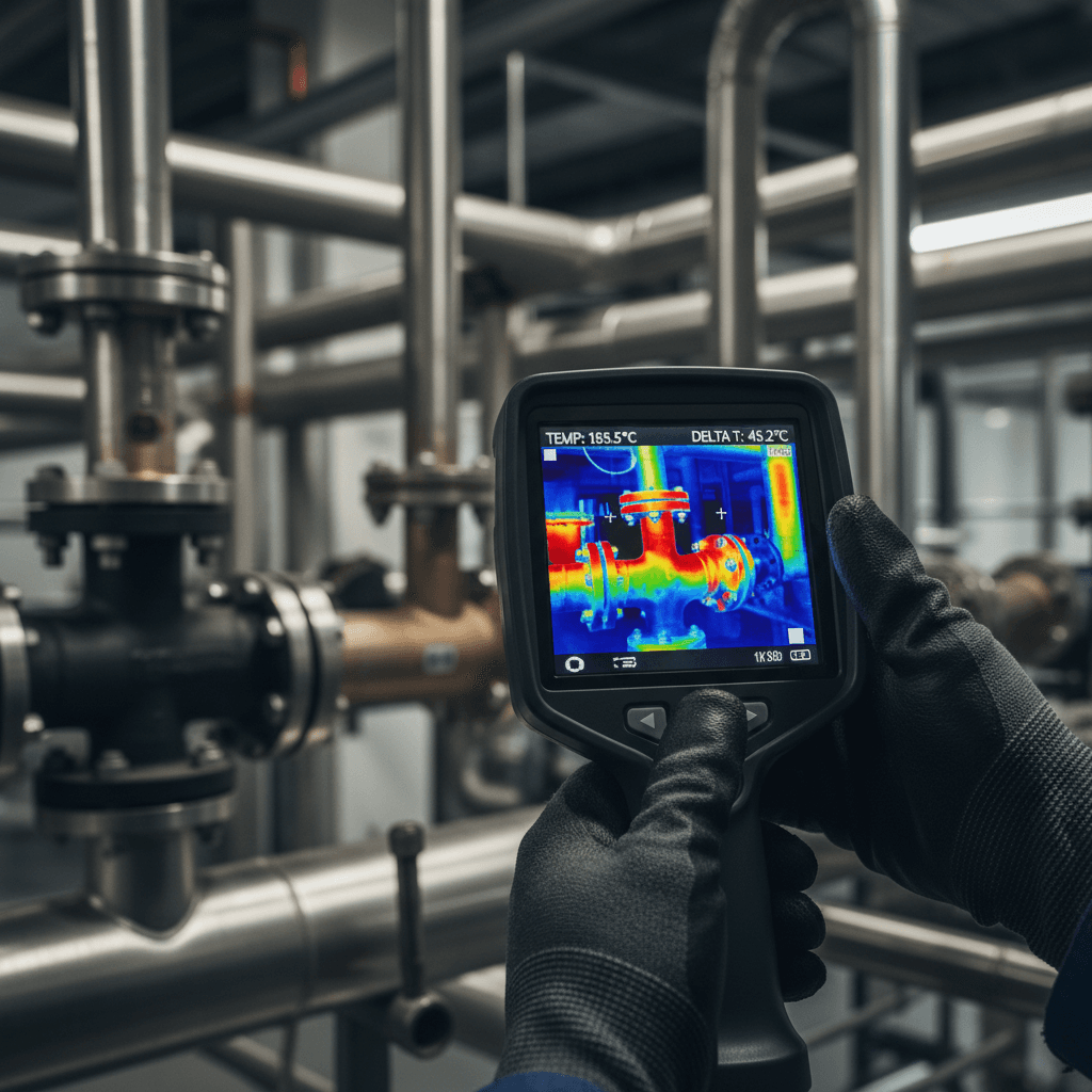
Detect heat loss, electrical faults, insulation gaps, and moisture patterns invisible to standard cameras.
Solar farm assessment
Identify panel degradation, hotspots, and wiring faults to maximize energy output and system reliability.
Water loss detection
Detect hidden irrigation leaks early to improve water efficiency, reduce operational costs and prevent costly seepage damage before it impacts productivity.
Data analysis reporting
Comprehensive reports with actionable findings, thermal maps, and detailed recommendations for remediation.
Emergency response support
Fast assessment and documentation for insurance claims, storm damage, and time-critical infrastructure issues.
Search and Rescue
ABS volunteer our expertise to support emergency services for for lost persons, and during times of natural disaster.
Biosecurity
ABS provides expert aerial and thermal support for biosecurity pest detection, monitoring and management across Australia — from Fire Ants to wild dogs and feral pigs.
Ready to schedule your inspection?
Contact ABS Drones and Thermal Imaging today. We'll respond promptly to discuss your project needs and provide a tailored solution.